Canoeing
Paint River
Iron County, 45 miles; 3 days to 1 week.
The Paint River rises in the west part of Iron County and flows easterly and southeasterly into the Brule River, finally joining the Michigamme River to form the Menominee River. Its bottom is gravel, sand and rock. Some of the feeder streams have trout and there are some trout in the Upper Paint, but the stream is generally known for Small Mouth Bass. The terrain is cutover poplar land, some swamp, plains, hardwoods and some pine.
There are two dangerous rapids, the Hemlock and the Horserace. The latter is a blinger. Don’t run them unless you are a super canoeist. The portage at Hemlock is 1/2 mile, Horserace is 1-1/2 miles. At the power dam take your canoe out 200 feet above the dam on the east side.
For the entire trip, put in at the Forest Service canoe landing in the Paint River Forks campground on County Road 657/Gibb City Road at Gibb City or on the township road 1/4 mile north of Gibb City. 6-1/4 miles below the Gibb City bridge, the Net River flows into the Paint. From here down the fishing is best for Northern Pike and Small Mouth Bass. You come to the first portage, Hemlock Rapids, 12-1/2 miles below the Gibb City bridge. You come to your first takeout spot 3-1/2 miles below the Hemlock Rapids at County Road 643/Bates-Amasa Road. Many use this as a starting point to avoid the Hemlock Rapids. You will find the Chicaugon Slough 4-1/2 miles below the 643 Road bridge. Seven and one-half miles below the 643 Road bridge is a public fishing site. This is where the bass fisherman put in. Two miles further on is the US-141 bridge, a good takeout spot.
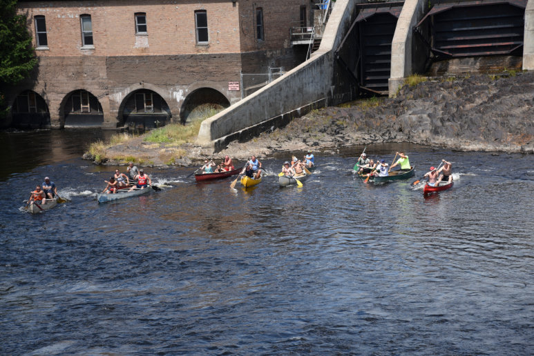
Three and one-half miles below the US-141 bridge is the Crystal Falls Power Dam. You’ll have to line your canoe down the river for 1/2 mile here or make a portage. You can get a truck to pick you up at the dam and take you down to the M-69 bridge, 1-1/2 miles below the power plant. Below the M-69 bridge you enter the backwaters of the Little Bull Power Dam which extends for a distance of about 9 miles. You may portage on the east shore near the dam and continue down the Paint River or by putting in at the diversion canal, you may enter the backwaters of Peavy Pond on the Michigamme River. One mile below the Little Bull Rapids there is a takeout on the right side. One mile below this takeout is the Horserace portage. One and one-half miles below the rapids there is a cleared camp site and road access to US-2 and 141. Four miles below the rapids the Paint River enters the Brule River. The best place to take out is 3-1/2 miles below the mouth of the Paint River at the Wisconsin-Michigan Power Dam in Wisconsin.

Net River
Iron County, 24.5 miles; 2 days.
The Net River starts in the upper central part of Iron County, close to US-141 and flows southeasterly to where it enters the Paint River. Logging roads cross the river a mile below the Wide-waters and just north of Mike’s Creek. Put in at Park Siding Road bridge 3/4 mile west of US-141. The east branch of the Net River flows 3/4 mile below the bridge. Six miles below there is the Wide-waters with some of the best Northern Pike fishing in the region. One mile south is Lake Dam. Six miles below the railroad bridge you reach Chipmunk Falls. There is a short portage here. Two and a half miles below is the Snake River. Large boulders make these rapids risky. Three miles to the Paint River.
Brule River
Iron County, 47 miles; 2 or 3 days.
The Brule is the border river between Wisconsin and Michigan, entering the Menominee River near Iron Mountain. It’s not a big river, and there are few rapids. Put in at M-73 bridge on the Wisconsin-Michigan border. Watch for shallow rapids. From this bridge to the bridge on M-189, 11-1/2 miles down stream, is good Rainbow Trout fishing. Six miles below the M-189 bridge the Iron River flows into the Brule. The water’s color becomes dull red because of iron ore, it has no effect on fishing. Another takeout spot is 3/4 mile below the mouth of the Iron River at Scott Lake. Other takeout spots are 3-3/4 miles below Scott bridge at Pentoga bridge, 3-1/2 miles further at Rainbow Trail bridge (Rainbow Trail bridge is only accessible from the Wisconsin side), 3 miles further at Carney Dam, 6-1/2 miles further at the US-2 141 bridge, 2 miles further at the Conservation Road terminal or continue 2-1/2 miles to the backwaters. The Paint River flows into the Brule River at this point. The Brule River has both Brook and Rainbow Trout.
